

So the story as I’m told is that what I recently stumbled upon during a recent trip just north of Lock Haven is called a logging dam. Logging Dams are also known as splash dams. And this is where the adventure begins. Two weeks ago I was on a roam. We needed to just get out and take a ride. We were short on gas so we headed north of Lock Haven to some old logging roads that are still maintained today and stared poking around. Eventually we ended up on a road called Rattlesnake Road (41.273235, -77.584764) . Once we reached this road’s end we found quite the unique little hidden dam just tucked away in the woods. 
We returned with just a few shots in my Iphone 6 for reference and I reached out to a few people that I know in the area to try to find out some information on the location. Only one person that I knew, was even aware of the location and he informed me about the type of dam he believed this dam to be. Subsequent online research revealed nothing on the location itself.
Fast forward a week and I just had to return to the site and take more pictures. Since this is not my normal type of post… I’m not going to worry about keeping this all super neat. There are lots of pictures and information to convey on a first draft of information. 🙂
-

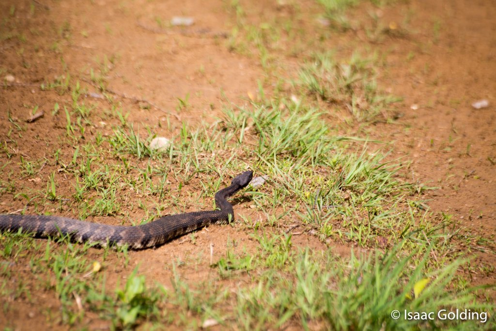
Um.. a snake. (rattler)
-

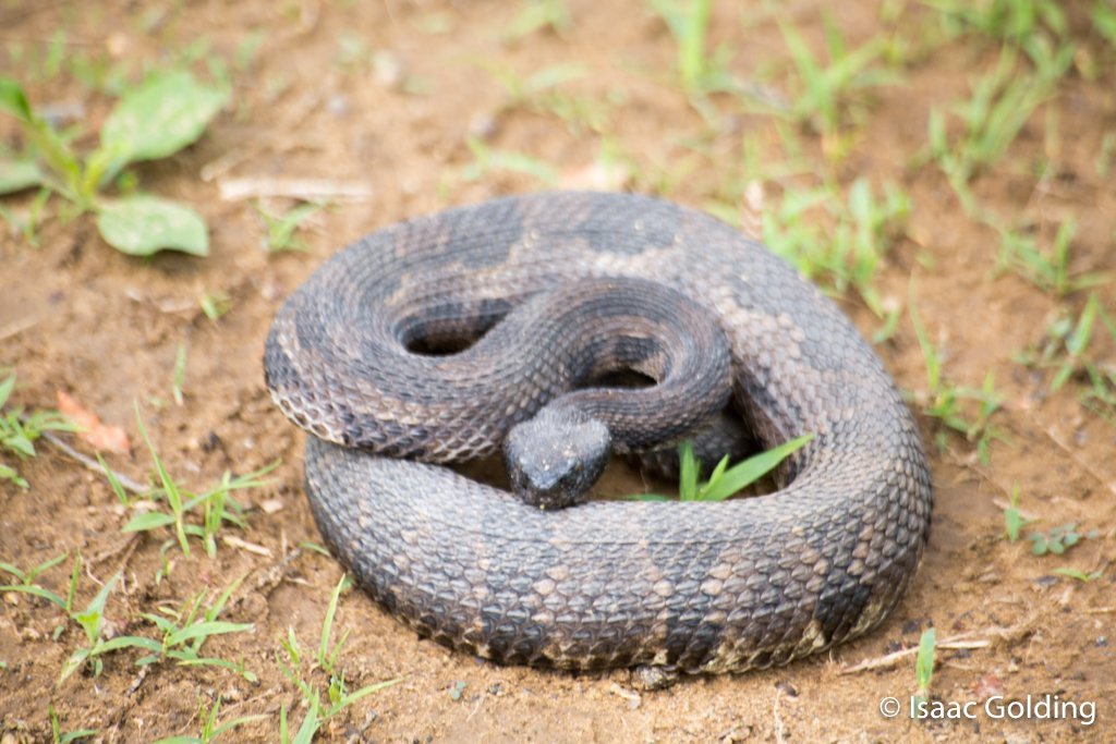
A mad snake. (rattler)
-

My brother Daryl and my other brother Daryl..
-

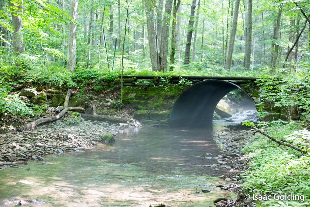
Sugar Camp Road Bridge crossing over Rattlesnake Run.
-

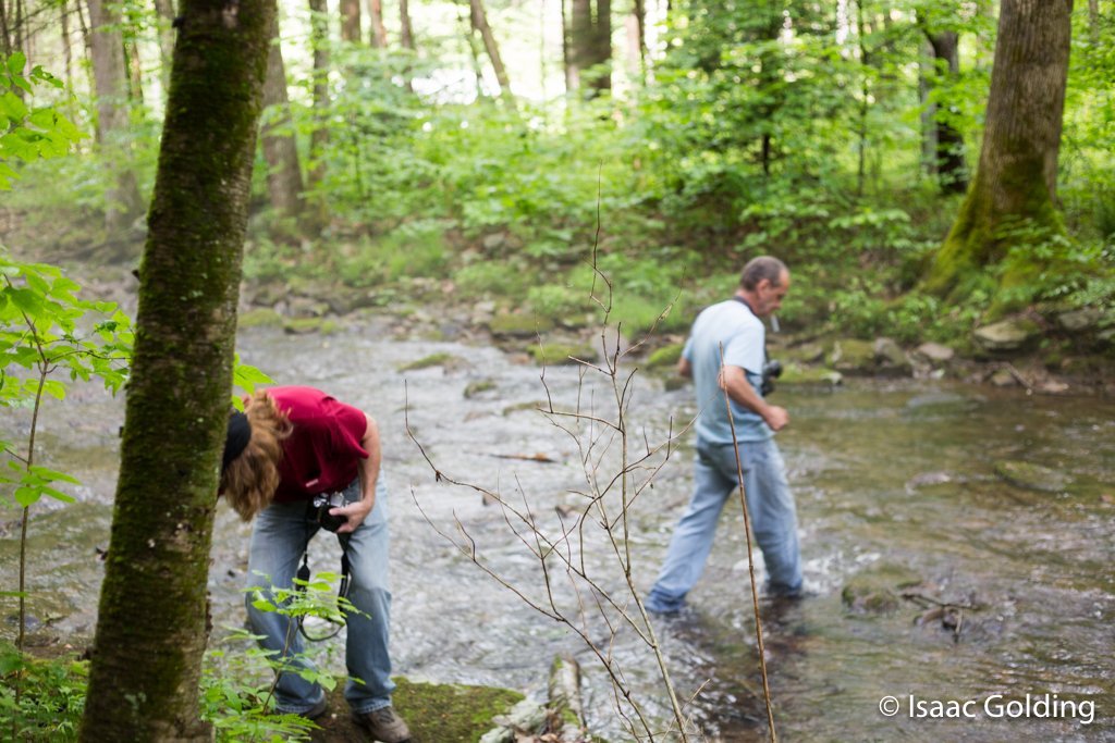
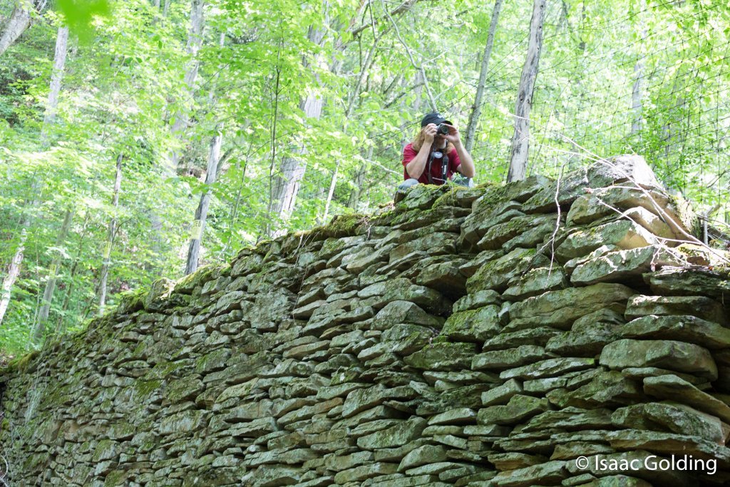
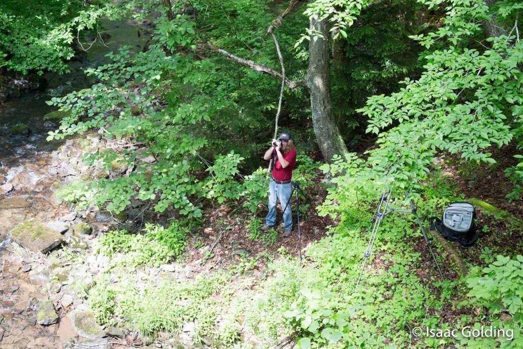
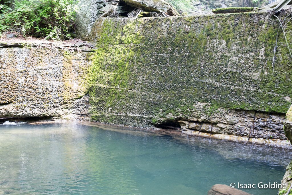
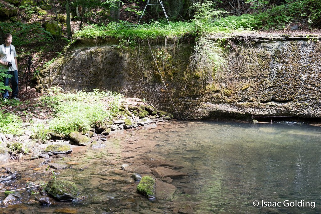
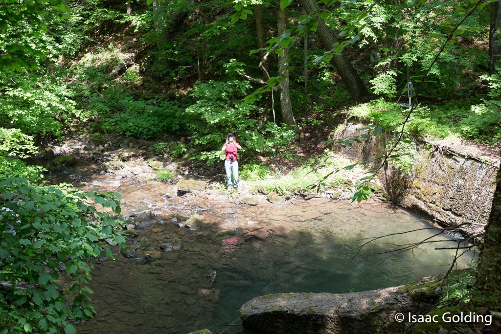
Northern downstream dam wall...with a photographer.
-

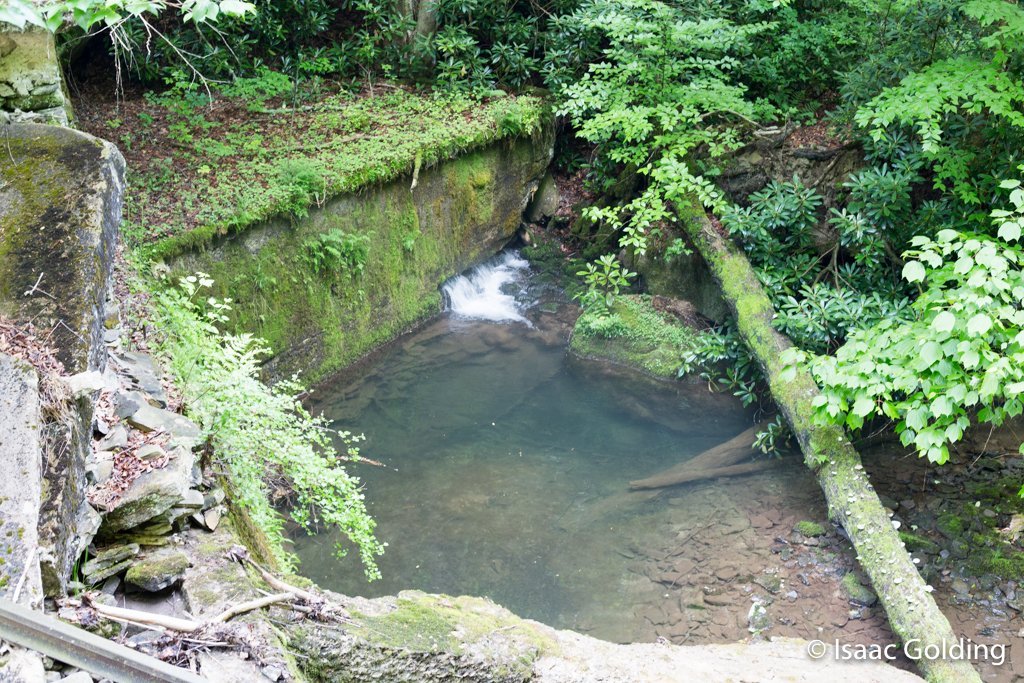
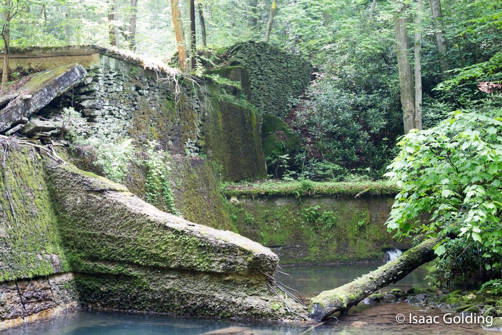
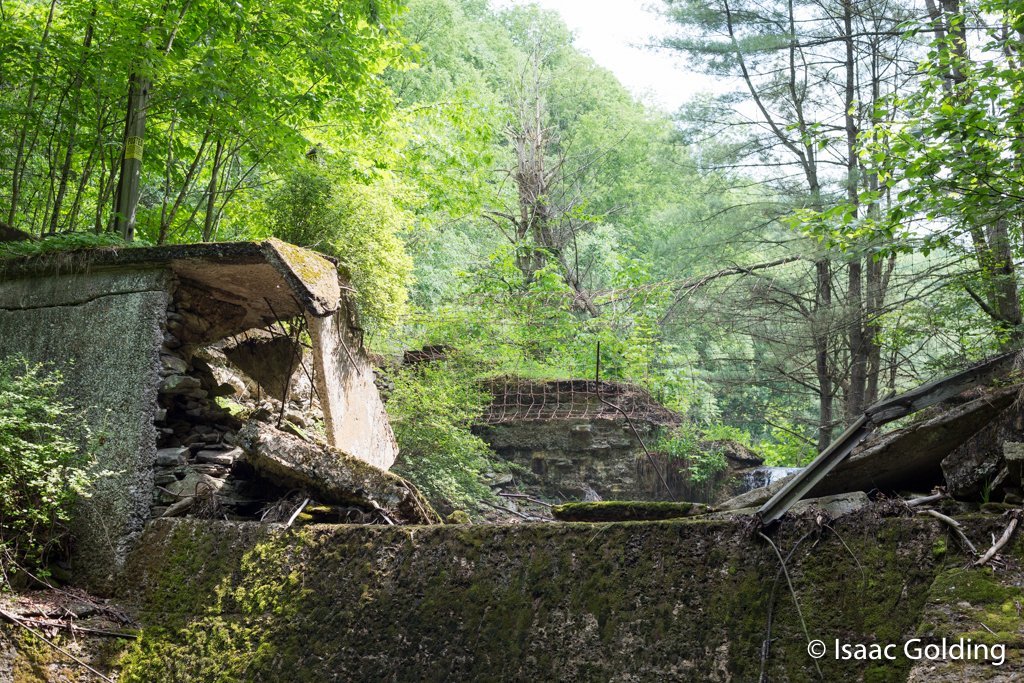
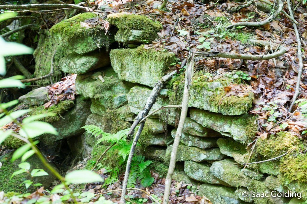
Inside the central cavity of the dam.
-

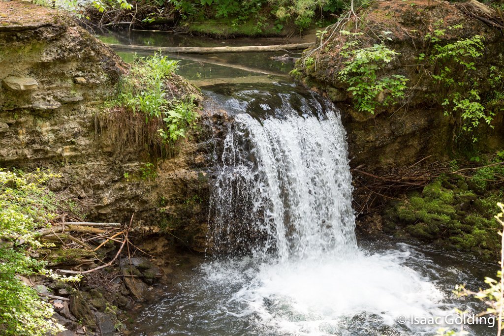
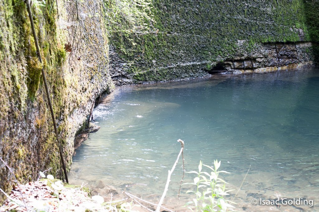
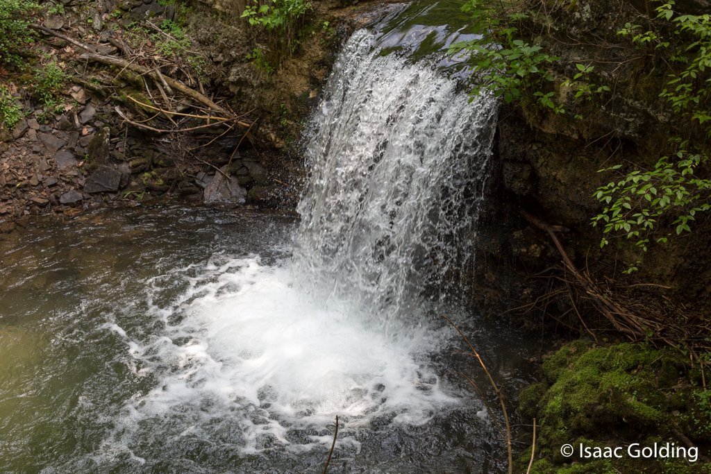
The waterfall was formed from erosion of the guts of the dam being washed away but the upstream wall still holding on.
-

Southern central cavity inside of the dam.
-

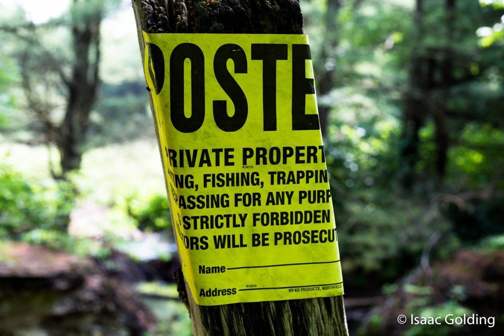
The upper section of the dam is Posted. I did not have permission to cross the property line. But anything I see I can take pictures of. 🙂
-

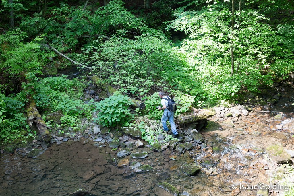
Another photographer
-

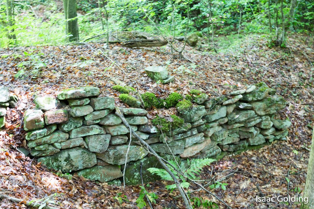
Southern lower portion of the dam on the downstream side
-

A photographer
-

Water flowing under the dam from the waterfall found inside the dam.
-

Mid southern dam wall downstream side
-

Southern dam wall donstream side
-

Center wall on the bottom downstream side of the dam.
-

Center wall, top middle portion of the lower dam face. Clearly damaged by flood waters over the years.
-

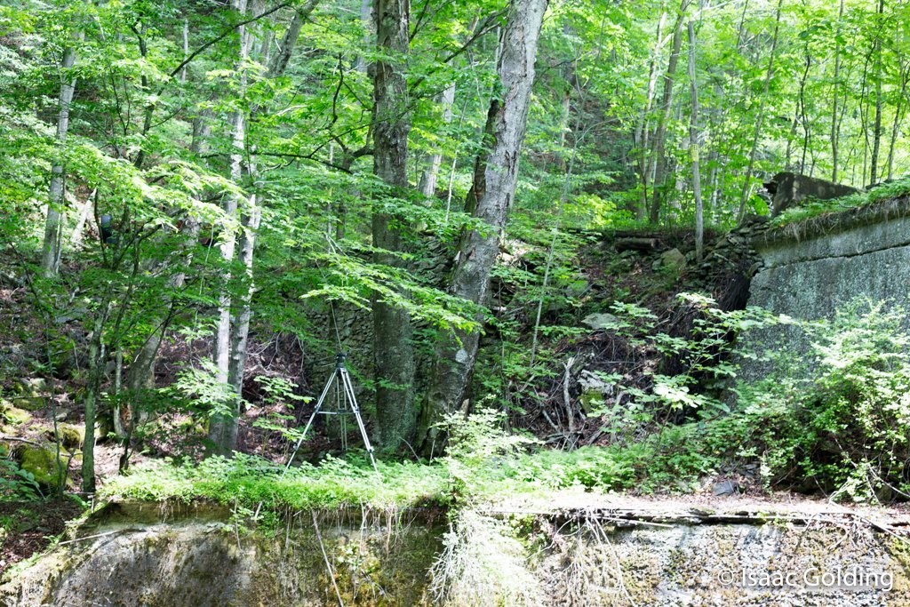
Middle of the northern dam wall with my tripod standing on it for sale purposes.
-

Lower northern dam wall again showing the bottom of my tripod for scale purposes.
-

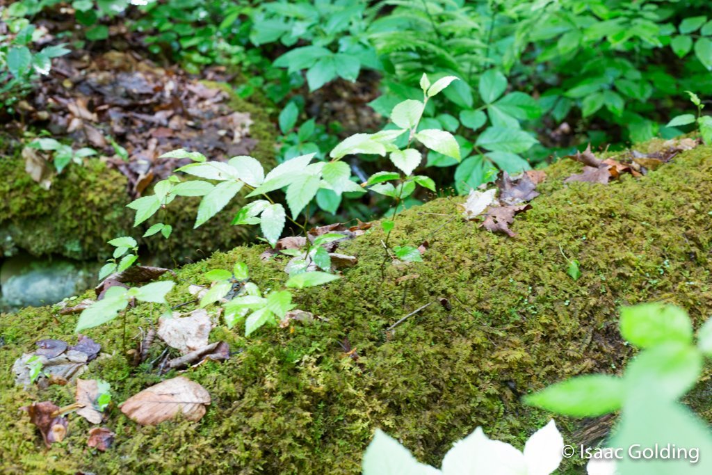
Moss covered log just under the dam.
-

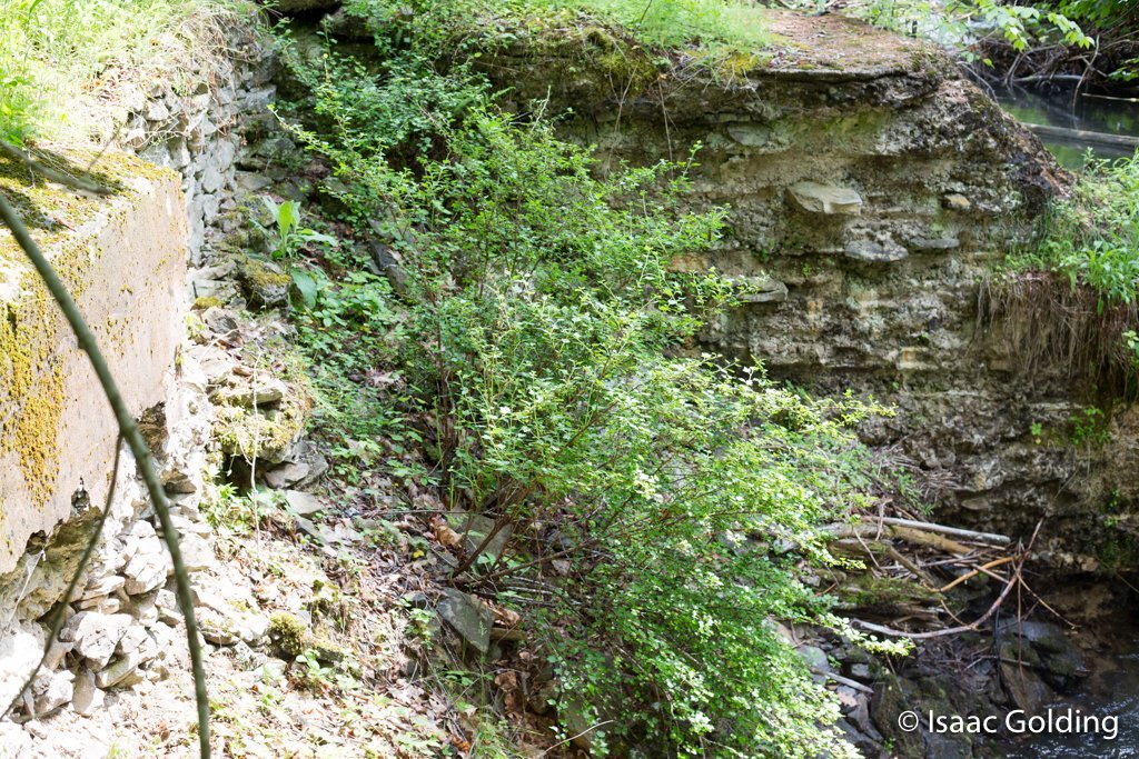
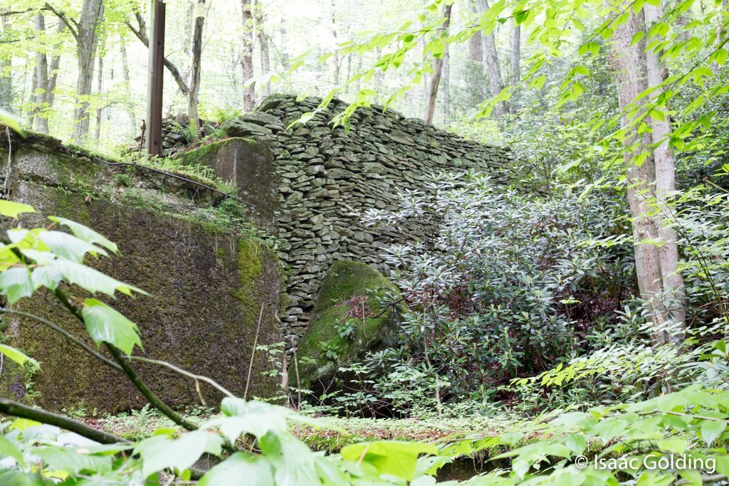
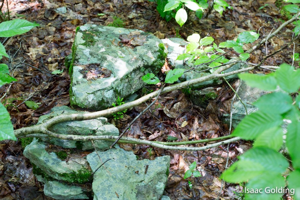
Building foundation near the dam.
-

Building foundation near the dam.
-

Building foundation near the dam.
-

Building foundation found just downstream of the dam.
-

Old firepit near the dam
-

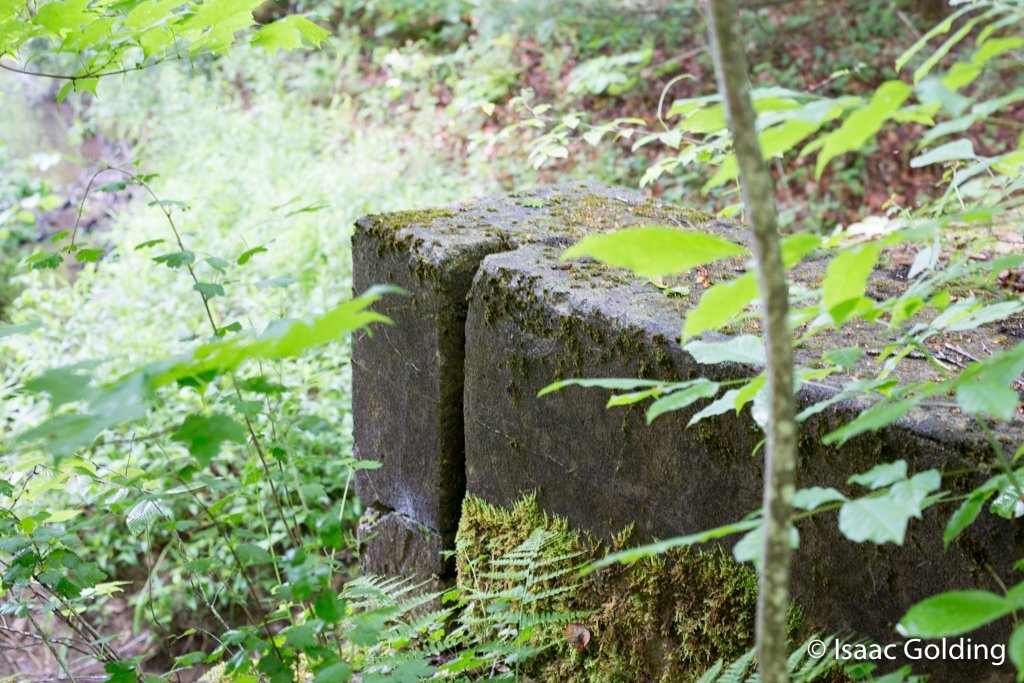
One of hte upper pylons of the dam.
-

Water pouring into the inside of the Dam as seen from the public side of the dam.
-

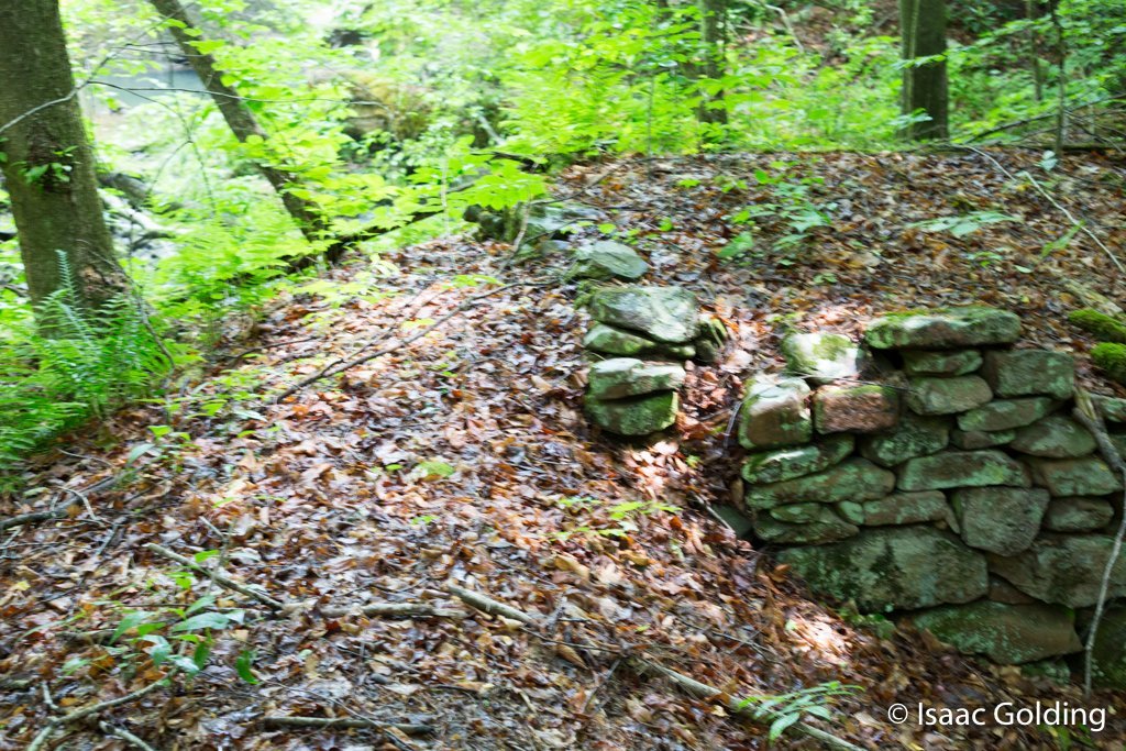
Southern edge of the dam wall
-

Another photographer taking pictures of the dam with me. Photographer is to scale.
-

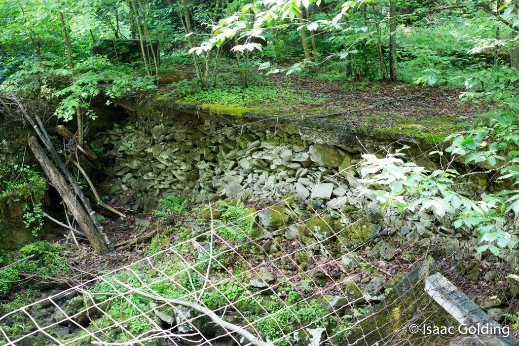
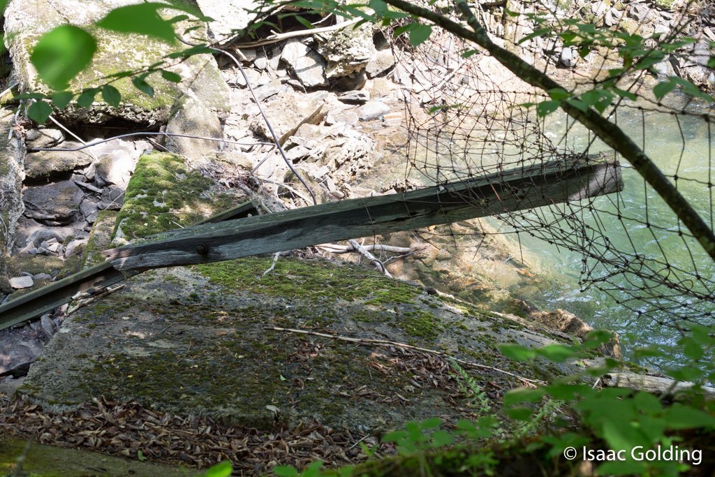
Old fencing and the inside of the dam structure.
-

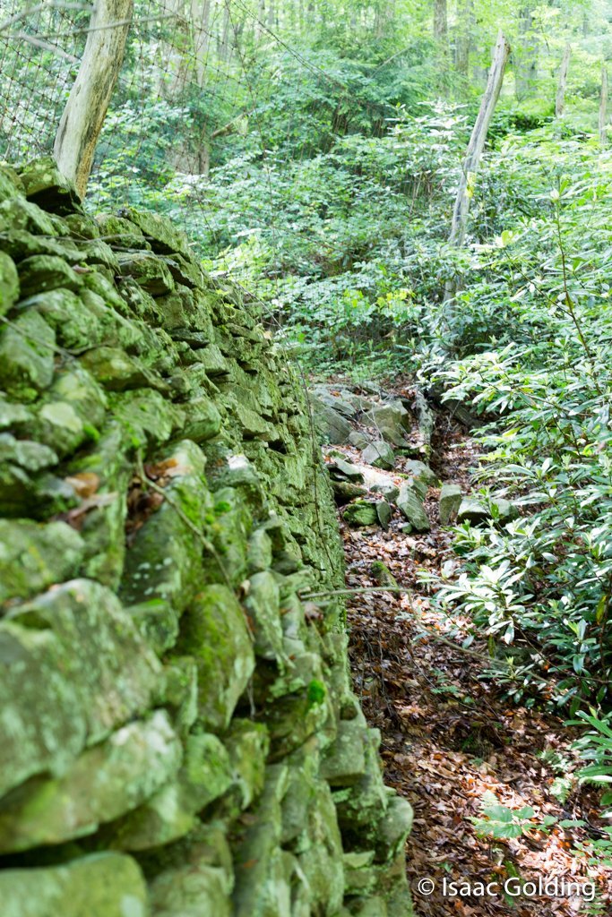
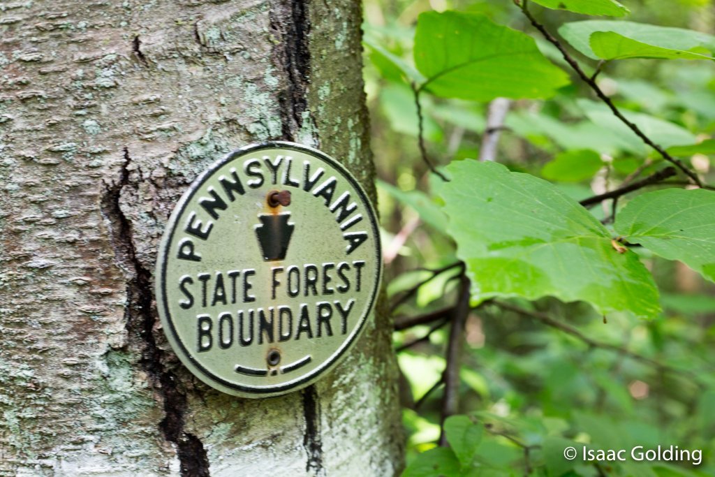
State Forest Boundary
-

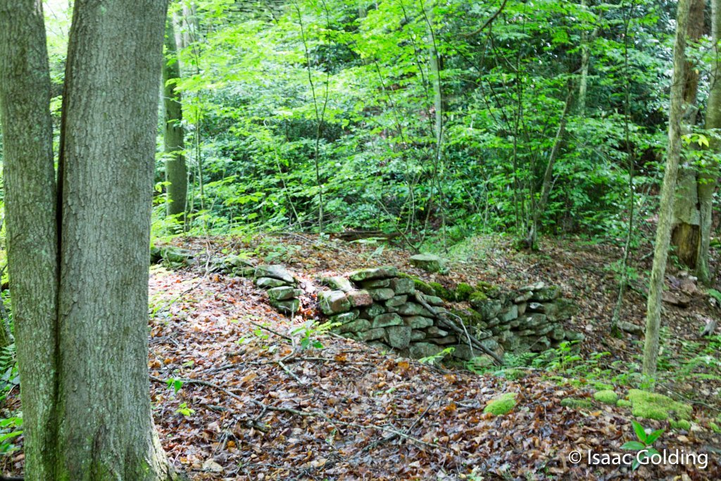
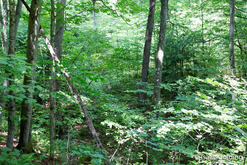
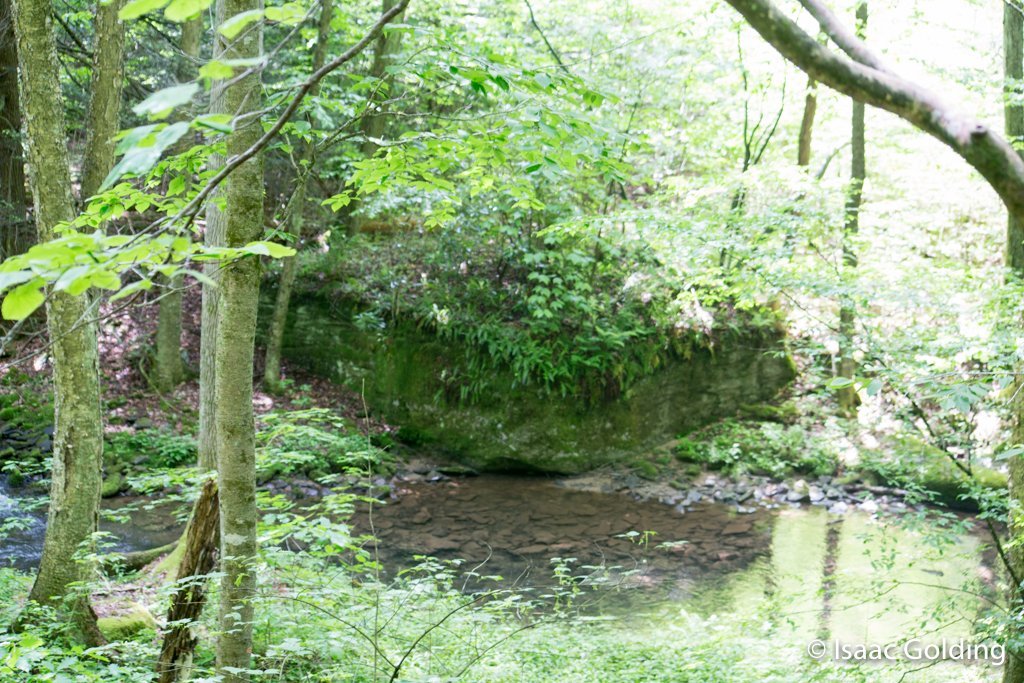
Rattlesnake Run Forest
-

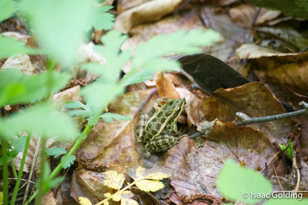
Frog
-

Rock...
So what I’m going to do with this page is for now continue to collect information and post it here. I’ll also post updates on my facebook page so those that are interested can keep abrest of any updates and developments.
I did search quite a bit on the web. Of specific intrest is the fact that I checked with USGS Name system and found no names or locations that matched coordinates close to this feature.
Direct Lat/Lon to the location
41.281457, -77.558758
Access to the location
You will need a pickup or other vehicle capable of climbing over rough gravel and stone roads to get within a mile of the location. 41.275400, -77.580292 will take you to the intersection of Rattlesnake and Sugar Camp Road. From there you will need to go on foot unless you own a Jeep. Higher clearances are needed to travel the rest of this route via vehicle. Hiking is preferred.
More info on Splash Dams can be found here.
http://en.wikipedia.org/wiki/Splash_dam